Distance Running Routes, In and Around Washington, D.C.
Out of Georgetown
Directions to 3300 Block of M Street, Georgetown
Get directions.
From DC
- Take M Street west
- Cross Wisconsin Avenue
- Proceed three blocks
From Virgina
- Cross Key Bridge.
- Turn right on M Street
- Proceed two blocks
Georgetown has numerous places to quench your thirst and sate your appetite.
Runs Heading East and South
Hains Point Loop (10 miles)
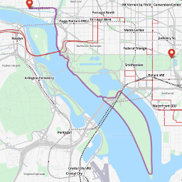 Miles: 10
Topography: Flat
Surface: Pavement/ Sidewalk
GPS Data: GPX, KML, MMR, OSM
The Hains Point route is flat as a pancake, as it traverses south along the the Potomac, into East Potomac Park. This is a good run from which to see National Airport and the Jefferson Memorial. The middle four miles are miles 18-22 of the Marine Corps Marathon. Thus this is a good run if you are prepping for that race. This route can be run on both weekdays and weekends.
Be aware that when the river is running high, Hains Point will flood. Also (for reasons unknown) Hains Point is very popular with motorists on Friday afternoon. Thus, you will want to avoid after 3:00 p.m. Friday. Usually, however, the traffic is so light that running is not a problem.
Directions
- Begin at the 3300 Block of M Street NW proceeding east
- Cross Wisconsin Avenue
- Branch right onto Pennsylvania Avenue (The Four Season Hotel is on your right)
- Turn right on exit ramp for Rock Creek Parkway. This is just beyond the Four Seasons Hotel
- Turn right on Rock Creek bike path, heading south
- Continue on bike path to 400 yards beyond Kennedy Center and bridge underpass
- Cross road, and bear left on path as it goes by volley ball courts. Do not stay straight and ascend ramp to Lincoln Memorial!
- Follow path thru second bridge underpass, keeping the Potomac River on your right. You will see steps leading to the Lincoln Memorial on your left
- Follow path as it parallels Potomac River, past Roosevelt Memorial
- Cross Bridge over Tidal Basin. Bear right
- You are in East Potomac Park/Hains Point. You will be sharing a road with cars, so be aware. When you reach Hains Point, this is mile 20 of the Marine Corps Marathon.
- As you exit Hains Point, after crossing back under 14th Street bridge, bear left and cross road.
- Head west across field, keeping Jefferson Memorial to your right and the 14th Street Bridge to your left.
- Cross Tidal Basin Bridge. You will recognize the path from your journey south.
- Retrace your route to Pennsylvania Avenue.
- Turn left on M St., and proceed .6 miles west to the finish.
14th Street Bridge – Key Bridge Loop (6.3 miles)

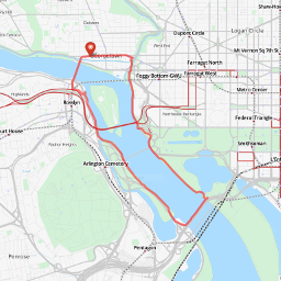 Miles: 6.3
Topography: Flat
Surface: Pavement/Sidewalk
GPS Data: GPX, KML, MMR, OSM
The 14th Street Bridge/Key Bridge Route provides excellent views of West Potomac Park, the Kennedy Center, the Lincoln Memorial, the Potomac River and the Georgetown skyline. There is one solitary hill, as one approaches Key Bridge. Otherwise the loop is flat. This route is mercifully free of traffic as well. The one drawback to this loop is the absence of shade along the Virginia side of the Potomac.
Those who wish to extend the loop can do Roosevelt Island (one mile circumference) which is accessible from the Mt Vernon Trail, half a mile north of Memorial Bridge.
This route can be run on both weekdays and weekends.
Directions
- Begin at the 3300 Block of M Street NW proceeding east
- Cross Wisconsin Avenue
- Branch right onto Pennsylvania Avenue (The Four Season Hotel is on your right)
- Turn right on exit ramp for Rock Creek Parkway. This is just beyond the Four Seasons Hotel
- Turn right on Rock Creek bike path, heading south
- Continue on bike path 400 yards beyond Kennedy Center and bridge underpass
- Cross road, and bear left on path as it goes by volley ball courts. Do not stay straight and ascend ramp to Lincoln Memorial!
- Follow path thru second bridge underpass, keeping the Potomac River on your right. You will see steps leading to Lincoln Memorial on your left.
- Follow path as it parallels Potomac River, past Roosevelt Memorial.
- Cross Bridge over Tidal Basin. Bear right.
- You are in East Potomac Park/Hains Point. Continue on road until first Bridge. This is the 14th Street Bridge. Turn left and ascend steps.
- Cross Bridge across Potomac.
- Once you reach the Mt. Vernon Trail (which parallels the Potomac) turn left and head north (upriver).
- Follow the path almost three miles north until you encounter intersection with road. Turn right.
- Cross Key Bridge. Once you get to M Street, turn right to return to start
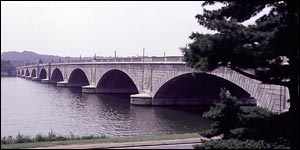
Memorial Bridge – Key Bridge Loop (4.7 miles)
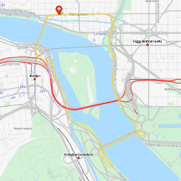 Miles: 4.7
Topography: Mostly Flat
Surface: Pavement/Sidewalk
GPS Data: GPX, KML, MMR, OSM
The Memorial Bridge/Key Bridge Route provides excellent views of the Kennedy Center, the Lincoln Memorial, the Potomac River and the Georgetown skyline. There is one solitary hill, as one approaches Key Bridge. Otherwise the loop is flat.
Runners should exercise caution when crossing the GW parkway. Physics teaches us that when a smaller object meets a larger object, smart money is on the latter.
Those who wish to extend the loop can do Roosevelt Island (one mile circumference) which is accessible from the Mt Veron Trail, half mile north of Memorial Bridge.
This route can be run on both weekdays and weekends.
Directions
- Begin at the 3300 Block of M Street NW proceeding east
- Cross Wisconsin Avenue
- Branch right onto Pennsylvania Avenue (The Four Season Hotel is on your right)
- Turn right on exit ramp for Rock Creek Parkway. This is just beyond the Four Seasons Hotel
- Turn right on Rock Creek bike path, heading south
- Continue on bike path to 400 yards beyond Kennedy Center and bridge underpass
- Continue straight and ascend ramp towards Lincoln Memorial
- Turn right after you pass statue of lion. Run down steps
- Follow sidewalk south. Do not cross road
- Bear left on sidewalk until you are on the south sidewalk of Memorial Bridge.
- Cross Memorial Bridge
- As you exit Memorial Bridge bear left towards the Mt. Vernon Trail. You will cross the GW parkway twice. EXERCISE CAUTION!
- Once you get on the Mt. Vernon Trail (which parallels the Potomac) turn left and head north.
- Follow path 1.5 miles north until you get to intersection with road. Turn right.
- Cross Key Bridge. Once you get to M Street, turn right to return to start
Runs Heading Due North
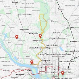
Nature Center – Bingham Drive Loop (15 miles)

 Miles: 15
Topography: Hilly
Surface: Pavement/Sidewalk/Trail
GPS Data: GPX, KML, MMR, OSM
This route is fairly challenging. The first five miles to Peirce Mill are a gradual ascent. Over the next 1.3 miles the hills become rather serious, until you reach the Rock Creek Nature Center. The Nature Center is the high point of the run. If you look west, you can sometimes see the National Cathedral and points beyond.
Upon Crossing Military road (300 yards east of Oregon Avenue), you will see remnants of a fort, built by Federal Soliders during the Civil War. This is rather fascinating to behold.
This route can be run on weekends or weekdays. As it will take you along the Valley trail for a mile and a half, you should be prepared for mud. Valley Trail has an absolutely abusive short hill in it, a mile south of Military. If you can run this without stopping, your quads are in very good shape.
Directions
- Begin at the 3300 Block of M Street NW proceeding east (toward downtown DC)
- Branch right onto Pennsylvania Avenue (The Four Seasons Hotel is on your right)
- Turn right on exit ramp for Rock Creek Parkway. This is just beyond the Four Seasons Hotel
- Turn left on Rock Creek bike path, heading north
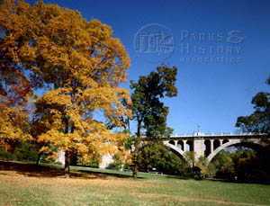
- Continue on Bike Path past the P and Q street bridges up to stop sign at Calvert Street (about 1.5 miles). Ahead of you will be the Taft and Duke Ellington Bridges, two very striking structures.
- Cross road. a quarter mile further take a sharp left, just before the tunnel.
- Proceed into National Zoo. The gate is closed from mid-October thru mid April at 5:00 p.m. During summer months, the gate is open until 8:00 PM.
- Go across service road and exit gate, to the other side of the bypassed tunnel
- From the far end of the zoo, continue on bike path 1.5 miles to Peirce Mill, which has bathrooms and drinking fountains.
- Continue past the mill. Bike path will merge into a short parking lot
- At end of Parking lot, take a quick left
- After 30 yards, take first right onto Glover Rd. This is an unmarked road
- Run up hill. Ignore first right, which is Ross Drive.
- Follows signs to Nature Center.
- Go to end of Nature Center parking lot. Follow path down to Military Road
- Get on Path on other side of Military. This is called the Western Ridge Trail
- Follow paved trail 3/4 of mile. Take a right on Bingham Drive. Bingham will be the first road you encounter that has a sidewalk (100 yards before Bingham, you will first cross a service road).
- Take a right on Beach Drive. Run to next stop sign
- At stop sign, turn right and cross bridge. Take immediate left on the Valley Trail.
- Follow Valley Trail as it runs parallel to Rock Creek. Avoid all trails to the right. A mile on the Valley is a very steep, muddy hill. If you can run this without stopping, you know your quads are in shape.
- As you exit trail, you will be at intersection of Beach Drive and Broad Branch Road.
- You are five miles from G’town at this point. Retrace route to start.
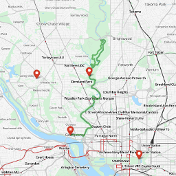
High Road – Ranger Station Loop (13.6 miles)
 Miles: 13.6
Topography: Hilly
Surface: Half Trail/Half Pavement
GPS Data: GPX, KML, MMR, OSM
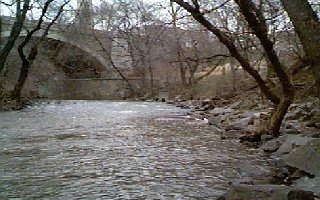
This route provides a view of some excellent bridge architecture over Rock Creek, and takes you to Ross Drive, arguably the most beautiful stretch of road in DC.
If you run this route of a weekday, use the Valley Trail, rather than Beach Drive for the first 1.6 miles of the return trip south. The loop is relatively challenging, with some abrupt hills and quick turns.
Ross Drive we call “High Road” for reasons that will soon become apparent to you. The U.S. Park Police Rock Creek Park Substation we call “The Ranger Station”, because it is less of a bureaucratic mouthful.
Directions
- Begin at the 3300 Block of M Street NW proceeding east (toward downtown DC)
- Branch right onto Pennsylvania Avenue (The Four Seasons Hotel is on your right)
- Turn right on exit ramp for Rock Creek Parkway. This is just beyond the Four Seasons Hotel
- Turn left on Rock Creek bike path, heading north
- Continue on Bike Path past the P and Q street bridges up to stop sign at Calvert Street (about 1.5 miles) Ahead of you will be the Taft and Duke Ellington Bridge, two very striking structures.
- Cross road, and .25 miles further take a sharp left just before the tunnel.
- Proceed into National Zoo. THe gate is closed from mid-October thru mid April at 5:00 p.m. During summer months, the gate is open until 8:00 PM.
- Go across service road and exit gate, to the other side of the bypassed tunnel
- From the far end of the zoo, continue on bike path 1.5 miles to Peirce Mill, which has bathrooms and drinking fountains.
- Continue past the mill. Bike path will merge into a short parking lot
- At end of Parking lot and stop sign, take a quick left
- After 30 yards, take first right onto Glover Rd. This is an unmarked road
- Run up hill. Take first right on Ross Drive. Like Glover, Ross is an unmarked road
- Ross Drive is the most beautiful mile of road in Washington. The view off to the right is particularly striking in the winter, when the bare trees reveal the depth of the valley formed by the creek over centuries
- Take a right at stop sign that marks the end of Ross Drive
- At this point you can take your first right on Valley Trail which runs on the West side of Rock Creek and follow to its end (bearing left whenever in doubt). Or you can cross the Bridge and take Beach Drive south. Not recommended however, when Beach Drive is open to traffic.
- Proceed south on either trail or Road 1.6 miles.
- At stop sign, cross road, and return to bike path.
- Retrace route to Pennsylvania Ave, NW
- Turn left on M St., and proceed .6 miles west to the finish.
Glover-Archbold Trail (10 Miles)
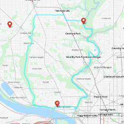 Miles: 10
Topography: Hilly
Surface: Pavement/Sidewalk
GPS Data: GPX, KML, MMR, OSM
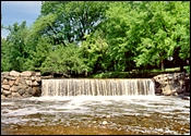
The following route describes a trail that heads north to Friendship Heights, east to Rock Creek park, and then south back to Georgetown. The loop is characterized by hills, trails, and a scamp thru one of the prettier neighborhoods in NW DC. Be aware that you will be running on dirt, so definitely wear trail shoes. Also – as the trail is isolated in sections, women should consider taking a running partner.
Many thanks to Josh Adelman for describing this route.
Directions
- Proceed down to the C&O Canal towpath, and head west (away from the city).
- After about .5 miles take a left down a flight of stairs
- Take an immediate right and go through the tunnel
- After exiting the tunnel continue right up the steep ramp
- When you reach the top, make a right onto the sidewalk
- Make an immediate right turn onto the trail. (this is the Glover-Archbold trail)
- Follow the Glover-Archbold trail about 2.8 miles until you hit VAN NESS STREET.
- Follow Van Ness until you reach CONNECTICUT AVEUNE
- Cross CONNECTICUT AVENUE and turn right.
- Go down two blocks and make a left on TILDEN ROAD.
- Follow TILDEN ROAD down a long hill into Rock Creek Park at Peirce Mill.
- Take a right on the Bike Path
- Follow bike path past the National Zoo
- Continue on path under the Duke Ellington and Connecticut Avenue Bridges
- Cross over CALVERT STREET.
- Follow Bike path 1.7 miles beyond CALVERT STREET to PENNSYLVANIA AVENUE. Get off here and turn left on M STREET
- Proceed West. Follow M STREET .6 miles back to start at 3300 Block.
Klingle Road – National Cathedral Loop (7.2 miles)

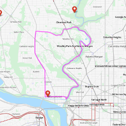 Miles: 7.2
Topography: Hilly
Surface: Sidewalk/ Pavement
GPS Data: GPX, KML, MMR, OSM
The Klingle Road-Cathedral Loop takes one through the National Zoo via the Rock Creek Bike path. Three and a half miles into the run, it ascends Klingle Road, a street closed back in the late 1980s because of severe drainage problems. Klingle Road is steep, and often has trees lying across it. This make it either fun or unpleasant to run, depending upon one’s perspective.
Half a mile after Klingle ends, you will reach Wisconsin Avenue, and the National Cathedral. This is the highest point in DC. On a clear day, you can see Virginia from this vantage. From National Cathedral to Georgetown, it is a 1.5 mile downhill descent via Wisconsin Avenue and 34th Street. You will in all likelihood be forced to stop at traffic lights.
This run can not be done at night, as Klingle lacks street lights.
Directions
- Begin at the 3300 Block of M Street NW proceeding east
- Cross Wisconsin Avenue
- Branch right onto Pennsylvania Avenue (The Four Season Hotel is on your right)
- Turn right on exit ramp for Rock Creek Parkway. This is just beyond the Four Seasons Hotel
- Turn left on Rock Creek bike path, heading north
- Continue on Bike Path past the P and Q street bridges up to stop sign at Calvert Street (about 1.5 miles)
Ahead of you will be the Taft and Duke Ellington Bridge, two very striking structures. - Cross road, and .25 miles further take a sharp left just before the tunnel.
- Proceed into National Zoo. The gate is closed from mid-October thru mid April at 5:00 p.m. During summer months, the gate is open until 8:00 PM.
- Go across service road and exit gate, to the other side of the bypassed tunnel
- From the far end of the zoo, continue on bike path .5 miles to Klingle
Road. Klingle Road is just before you cross under the Porter Street Bridge. Take a left on Klingle. - Klingle is closed to cars. Run up a consideral hill .75 miles to Woodley Road. There may be trees across the road – in which case you can do a steeplechase workout simultaneous with your hill workout.
- Take a right on Woodley. Proceed up to Wisconsin Avenue. The National Cathedral will be on your left.
- Take a left on Wisconsin. Run to 34th Street, which is just across from the Safeway.
- Take a right on 34th. Proceed back to M Street, and start of run.
Dumbarton Oaks – Georgetown Loop (4 miles)

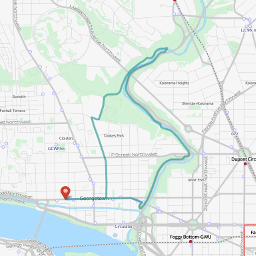 Miles: 4
Topography: Hilly
Surface: Pavement/Trail/sidewalk
GPS Data: GPX, KML, MMR, OSM
The Dumbarton Oaks-Georgetown Loop takes you up Rock Creek and back through one of the most beautiful parts of DC – Dumbarton Oaks and Upper Georgetown. Dumbarton Oaks is 19th century mansion that enjoys ten acres of outdoor gardens and rolling lawns. The run finishes along 31st Street Georgetown, a road lined with some of the beautiful homes for which Georgetown is so renowned.
Be advised: The part of the the run approaching Dumbarton Oaks is along a secluded trail. Though this is a very safe part of the DC, runners should exercise common sense. The approach to Dumbarton includes a steep grade of 150 yards, prior to reaching the tennis courts. If you can run this, you are a hill beast.
Directions
- Begin at the 3300 Block of M Street NW proceeding east
- Cross Wisconsin Avenue
- Branch right onto Pennsylvania Avenue (The Four Season Hotel is on your right)
- Turn right on exit ramp for Rock Creek Parkway. This is just beyond the Four Seasons Hotel
- Turn left on Rock Creek bike path, heading north
- Continue on Bike Path past the P and Q street bridges.
- After passing under the Q Street Bridge, you will cross a bridge the east side of Rock Creek. At this point the bike path will be located between the creek and the parkway.
- In another half mile, the trail will again cross Rock Creek.
- Immediately after bridge, take a sharp left on the (unmarked) Whitehaven Trail. Do not go up steep hill. If you encounter a stop sign and Calvert Street, you have gone too far.
- Continue on trail south as it runs parallel to Rock Creek. Soon after passing under Massachusetts Avenue, it will curves uphill and to the right.
- Within a quarter mile after passing under Massachusetts Ave., you will encounter an unmarked dirt lane. This is Lovers Lane, and the entrance to Dumbarton Oaks. Turn left on Lovers Lane and ascend steep hill.
- Proceed a quarter mile to end of Lovers Lane.
- Turn right on R Street.
- Take first left onto 31st Street.
- Run down 31st Street to M Street. This has a narrow sidewalk so be careful!
- Turn right on M Street. Proceed back to start of run.
Runs Heading into Virginia
Mount Vernon Trail
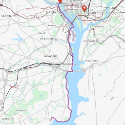 Miles: ≤ 37 miles, out and back
Topography: Flat
Surface: Bike Trail
GPS Data: GPX, KML, MMR, OSM
The Mount Vernon Trail runs south from Georgetown along the Virginia side of the Potomac. After eighteen miles, it terminates at Mount Vernon, the estate where George Washington spent his final years. This route is paved; thus on weekends runners can expect numerous bicyclists and roller-bladers. This is especially pronounced as the trail enters Old Town, Alexandria, ten miles south of Georgetown. Smart runners will start early.
The virtue of this route is that it is virtually impossible to get lost. It also has scenic vistas of the Potomac. If you want to make a one way trip of it, take the Trail to Old Town, and run west one mile along King Street to the King Street Metro. Take back to DC – Foggy Bottom is the closest Metro to Georgetown.
The Potomac Runners sponsor a Saturday morning run along the southern reaches of the trail.
Directions
- Begin at the 3300 Block of M Street NW proceeding west
- Take left at Key Bridge.
- Turn left at trailhead. This is just before you encounter the exit ramp for Route 66.
- Proceed south. Mile markers will help you determine pace and distance. Turn around halfway.
Custis Trail Corkscrew Ascent (9.8 miles)
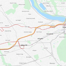 Miles: 9.8
Topography: Hilly
Surface: Bike Trail
GPS Data: GPX, KML, MMR, OSM
The Custis Trail runs parallel to I-66 in Arlington. Runners coming out of Georgetown should expect a significant hill, culminating in the infamous “Corkscrew” where the route crosses Lee Highway. The fact that the Corkscrew comes after a 1.5 mile ascent makes it especially abusive. If you can Corkscrew without breaking stride, you are true distance dog. The halfway point is where the trail meets the WO&D Trail. Runners who wish to run further can proceed along this trail.
Be advised: Portions of this route are secluded from view. Though the trail runs through a safe part of Arlington, runners should exercise common sense, and run with a partner when in doubt.
Directions
- Begin at the 3300 Block of M Street NW proceeding west
- Cross Key Bridge
- Turn right on sidewalk that parallels Lee Highway.
- As you proceed up hill, you will see the Mariott Hotel on your right. Follow signs.
- Proceed on trail 4.5 miles. The first 1.5 miles are uphill (ouch!).
- When you encounter the WO&D trail, (another paved path) turn around. You will meet this trail 0.1 miles after crossing under I-66. There is a water fountain at this point as well.
- Return to Georgetown
Tour D’Arlington (16.7 miles)

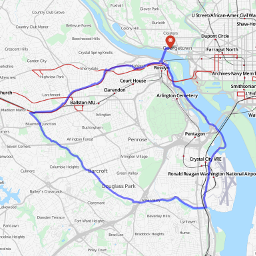 Miles: 16.7
Topography:Moderately Hilly
Surface: Bike Trail
GPS Data: GPX, KML, MMR, OSM
The Tour D’Arlington route connects four distinct bike paths (Mount Vernon, Four Mile Run, WO&D and Custis Trail). While this is not a terribly hilly route, the first nine miles can be awful in the summer, as there is little shade. Be aware of cyclists. While the vast majority of cyclists are well behaved, there are an unfortunate few who combine the velocity of Lance Armstrong with the navigational abilities of Halle Berry.
This route can be confusing – especially with the approach to Shirlington and crossing I-395. Be sure to study the map carefully.
Directions
- Begin at the 3300 Block of M Street NW proceeding west
- Take left at Key Bridge.
- Turn left at trailhead. This is just before you encounter the exit ramp for Route 66.
- Proceed south.
- At the southern edge of the airport, take Four Mile Run West. Go under bridge, not over.
- Follow Four Mile Run. Whenever trail branches, bear left, following signs
- Approaching Shirlington,
a short on-road detour is required to cross I-395(see the Detailed Map, courtesy of Bike Washington) Update: No detour! Continue directly to WO&D Trail - 0.3 miles after entering Shirlington, you will meet the WO&D Trail
- Follow WO&D four Miles.
- At mile marker #4, the trail meets I-66. Turn Right on Custis Trail
- Follow Custis Trail Four Miles to Fort Meyer Drive
- Cross Key Bridge, back into Georgetown
Runs Heading Northwest, towards Maryland
C&O Canal
 Miles: ≤ 368 miles, out and back
Topography: Flat, with hills at locks
Surface: Hard Dirt
GPS Data: GPX, KML, MMR, OSM
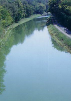
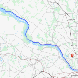
The C&O Canal is 185 miles long, beginning in Georgetown and continuing to Cumberland, Md. It is rather popular with bikers and hikers, especially south of Chain Bridge, and near Great Falls.
The path is flat, shaded with mile markers, making this an excellent marathon training run. Water fountains at Fletchers Boathouse, and at mile marker #5. The only possible drawback to this route is an absence of challenging hills. You may or may not consider this a problem. For much more information, see the C&O Canal Virtual Tour.
Directions
- Begin at the 3300 Block of M Street NW proceeding west
- Take left at Francis Scott Key Park (just before Key Bridge)
- Drop onto the C&O Canal.
- Head west on C&O Canal towpath toward Maryland. Mile Marker #2, which is missing, used to be 20 feet west of Key Bridge
- Turn around halfway through your run.
Old Anglers Inn Loop (23 miles)
 Miles: 23
Topography: Flat
Surface: Trail/Pavement
GPS Data: GPX, KML, MMR, OSM
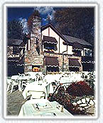
This is a run that takes you up to Potomac via the C&O Canal, and back to Georgetown via Macarthur Blvd. Bruce Coldsmith and Tem Washington extensively trained on this route back in the early 1980s. It fell into disuse, after the Park Service began closing Beach Drive on weekends, and Capital Crescent Trail opened in 1996, giving us other options. But it is still a good run.
Notes about this route: It is a gradual ascent to Potomac, MD. Coming back along Macarthur Blvd., be prepared to share the path with bicyclists. South of Cabin John, there are some decent vistas overlooking the Potomac. Once reaching DC, you will need to run along a sidewalk of (literally) uneven quality. Be careful!
Shade along Macarthur Blvd varies. The two miles south of Old Angler’s Inn are exposed. This condition also obtains on the two miles north of the DC line. The final four miles enjoy excellent cover.
Finally – be aware that there is only one water fountain along Macarthur (in Cabin John) – so consider stashing some aqua the night before along the run.
Directions
- Begin at the 3300 Block of M Street NW, proceeding west
- Take left at Francis Scott Key Park (just before Key Bridge)
- Drop onto C&O Canal.
- Head west on C&O Canal towpath toward Maryland.
- At 1/2 mile beyond Mile Marker 12 (which is 11.5 miles into the run), turn right and cross bridge over the canal. Head up hill toward Macarthur Blvd. and Old Anglers Inn.
- Turn right on Macarthur Blvd. Head back to DC.
- Half a mile before Georgetown, Macarthur Blvd. ends. Take a right on Canal Road. Proceed to M Street.
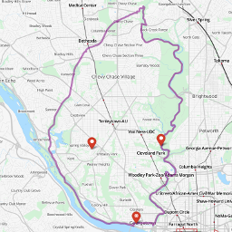
Capital Crescent – Rock Creek Loop (21 miles)
 Miles: 21
Topography: Ascent thru Bethesda
Surface: Pavement
GPS Data: GPX, KML, MMR, OSM
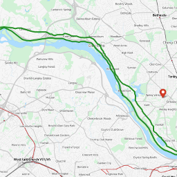
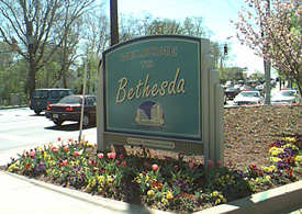
This route represents a challenging marathon training run. It was first made possible in 1997, with the opening of the Georgetown Branch extension of the Capital Crescent Trail. The first eight miles is a gradual ascent into Maryland. Two miles east of Bethesda, the route intersects Rock Creek Park. Runners then head south along Rock Creek, towards Georgetown, in a gradual descent. The last nine miles are on Beach Drive/Rock Creek Parkway.
Two important notes:
Directions
- Begin at the 3300 Block of M Street NW proceeding west
- Take left at Francis Scott Key Park (just before Key Bridge)
- Drop onto C&O Canal and Water street, which is below the C&O.
- Head west on K Street. After passing under the Key Bridge, K Street becomes the Capital Crescent Trail.
- Continue on trail for about seven miles into Bethesda.
- You will cross over both Massachusetts Avenue and River Road before reaching Bethesda. When you see Barnes and Noble, you are 2 blocks west of Wisconsin Ave
- Cross street. Pass through the Wisconsin Avenue Tunnel continuing east.
- You are now on the Georgetown Branch Trail. Continue across Connecticut Aveue.
- Two-thirds of a mile beyond Connecticut Avenue is the intersection with Jones Mill Road.
- Cross Jones Mill Road.
- Turn left on Jones Mill Road.
- Turn right in 30 yards onto Susanna Lane.
- At the end of Susanna Lane a bike path begins. In about 1/10 mile the path joins the Beach Drive trail.
- Turn right on trail to return to DC.
- At this point, ignore all signs for the Georgetown Branch trail. In approximately 0.75 miles you will meet East-West Highway.
- Turn right. Run 300 yards to Beach Drive.
- Turn left on Beach Drive. This portion of Beach Drive is open to traffic, so proceed carefully!
- Proceed one mile to DC line and thru traffic gate. Continue south.
- Follow Beach Drive 4.3 miles until reaching Broad Branch Road.
- At Broad Branch, exit roadway and begin running on bike path.
- Follow bike path past the National Zoo
- Continue on path under the Duke Ellington and Connecticut Avenue Bridges
- Cross over Calvert Street.
- Follow Bike path 1.7 miles beyond Calvert Street to Pennsylvania Avenue. Get off here and turn left on M Street
- Proceed West. Follow M Street .6 miles back to start at 3300 Block. Drink refreshments, revel in your accomplishment
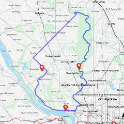
Northwest Passage (18 miles)
 Miles: 18
Topography: Hilly
Surface: Pavement
GPS Data: GPX, KML, MMR, OSM
The following route describes a Georgetown based 18 mile run. This route is characterized by hills, excellent shade and good scenery. It takes you along the Maryland/DC line from miles 3.5 to 9, thru some very attractive neighborhoods. The first nine miles are on roads populated with traffic, so be aware. The last nine miles are on Beach Drive/Rock Creek Parkway.
This this route should be RUN ONLY ON WEEKENDS when the upper NW DC portions of Beach Drive are closed to traffic.
Directions
- Begin at the 3300 Block of M Street NW proceeding west
- M ST NW becomes CANAL RD NW.
- Stay straight to go onto MACARTHUR BLVD NW.
- Turn SLIGHT RIGHT onto FOXHALL RD NW.
- Turn LEFT onto MACARTHUR BLVD NW.
- Turn LEFT onto RESERVOIR RD NW.
- RESERVOIR RD NW becomes MACARTHUR BLVD NW after a mile
- Proceed west on MACARTHUR BLVD until CHAIN BRIDGE ROAD
- Turn right on CHAIN BRIDGE ROAD to NEBRASKA AVENUE. This is a major hill of pain
- After .4 miles, turn LEFT onto MASSACHUSETTS AVENUE NW.
- Go one mile to the WESTMORELAND CIRCLE roundabout.
- Turn Right. The road will be WESTERN AVE.
- Follow WESTERN AVENUE across both WISCONSIN AVENUE and CONNECTICUT AVENUE to DANIEL ROAD
- Turn left on DANIEL ROAD
- Follow to WYNDALE ROAD
- Turn right on WYNDALE. Proceed until stop sign
- Turn right on BEACH DRIVE
- Follow BEACH DRIVE 4.3 miles until Peirce Mill
- At Peirce Mill, exit roadway and begin running on bike path.
- Follow bike path past the National Zoo
- Continue on path under the Duke Ellington and Connecticut Avenue Bridges
- Cross over Calvert Street.
- Follow Bike path 1.7 miles beyond Calvert Street to Pennsylvania Avenue. Get off here and turn left on M Street
- Proceed West. Follow M Street .6 miles back to start at 3300 Block.
Single Lane Bridge Route (14 miles)
 Miles: 14
Topography: Flat
Surface: Pavement/Trail
GPS Data: GPX, KML, MMR, OSM
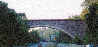
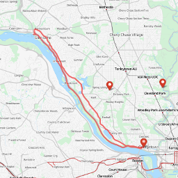
This route heads Northwest along the C&O Canal and returns to Georgetown via the MacArthur Blvd. The highlight is the turnaround point, where you get a excellent view of the Cabin John Aqueduct, a 220-foot single span masonry arch – the world’s largest for more than 40 years (between 1863 and 1903).
This particular route was pioneered by Gerry Ives, one of the founding fathers of the WRC, who tends to run it at 4:30 in the morning (unfortunately, the world has not yet devised a 12 step program for the likes of him).
This route can be run on both weekdays and weekends.
Directions
- Begin at the 3300 Block of M Street NW proceeding west
- Take left at Francis Scott Key Park (just before Key Bridge)
- Drop onto C&O Canal.
- Head west on C&O Canal towpath toward Maryland.
- Cross the canal at the footbridge 1/2 mile past lock 7 (about 7 miles from Georgetown).
- Bear to the right immediately after crossing the bridge.
- Approximately 100 meters later, bear to the left underneath the Clara Barton Parkway.
- Follow the trail up to MacArthur Blvd. You will see the famous Cabin John “single lane bridge” to your left.
- Turn right on the bikepath along MacArthur Blvd. Follow bikepath back into DC. The bikepath ends at the DC line, but you can run on the sidewalk all the way back to Georgetown.
- MacArthur Blvd. runs into Foxhall Road at mile 13 of the return run. Turn right on Foxhall down to Canal Road.
- Follow Canal Road back to Georgetown.
Brookmont – MacArthur Blvd Loop (9.3 miles)
 Miles: 9.3
Topography: Flat
Surface: Trail/Pavement
GPS Data: GPX, KML, MMR, OSM
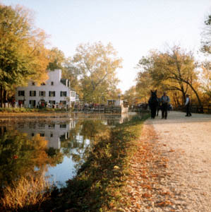
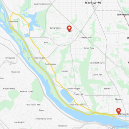
This route heads northwest on the C&O Canal and returns to Georgetown via Brookmont and the MacArthur Blvd. Brookmont is a small community, tucked between MacArthur Blvd, and the Canal, where many of Washington’s elite Kayakers live and train.
This route can be run on both weekdays and weekends.
Directions
- Begin at the 3300 Block of M Street NW proceeding west
- Take left at 34th street at Francis Scott Key Park (just before Key Bridge)
- Drop onto the Potomac side of the C&O Canal.
- Head west on C&O Canal towpath toward Maryland.
- 3/4 of a mile beyond Chain Bridge, just after miler marker 5, will be a footpath cross Canal Road. Follow this path.
- Go up trail immediately after crossing the bridge.
- Turn left on Ridge Road.
- Turn right on Maryland Avenue.
- Turn right on the bikepath along MacArthur Blvd. Follow bikepath back into DC. The bikepath ends at the DC line, but you can run on the sidewalk all the way back to Georgetown
- MacArthur Blvd. runs into Foxhall Road at mile 6 of the return run. Turn right on Foxhall down to Canal Road.
- Follow Canal Road back to Georgetown.
Out of Peirce Mill, Rock Creek Park
Directions to Peirce Mill
Get directions. Learn more from nps.gov.
From Beltway
- Take Exit 33, and go south 4.3 miles on Conecticut Ave. (MD 185).
- Turn left on Tilden Street.
- Go 0.4 miles.
- Turn left into Peirce Mill Parking lot, 30 yards before bridge.
From DC (Corner of Connecticut Ave and K St NW)
- Proceed North up Connecticut Avenue, through Cleveland Park.
- Turn right on Tilden Street.
- Go 0.4 miles.
- Turn left into Peirce Mill Parking lot, 30 yards before bridge.
Western Ridge – Valley Trail Loop (9.4 miles)

 Miles: 9.4
Topography: Hilly
Surface: Pavement/Trail
GPS Data: GPX, KML, MMR, OSM
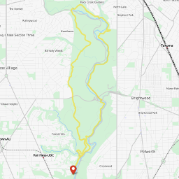
This loop originates at Peirce Mill. The first two miles of this loop are on road. The next 2.5 miles are along the Western Ridge trail, as you head North, towards Maryland. After descending to the Valley Trail, it turns east and south, as it heads back to Peirce Mill. The first half of the loop is characterized by challenging hills. The last half is flat. There are some awfully pretty views of the Rock Creek, after it rains.
Directions
- Begin at Peirce Mill proceeding North
- At end of Parking lot and stop sign, take a quick left
- After 30 yards, take first right onto Glover Rd. This is an unmarked road
- Run up hill.
- Continue on Glover Road for two miles until you reach Military Road
- Cross Military Road. Turn right on paved bike trail. This marks the beginning of the Western Ridge Trail
- Continue on paved bike path across Bingham Drive
- 100 yards after crossing Bingham, a dirt path emerges on right. Turn right on this path.
- After 200 years, bear left(north) down hill.
- You will see a number of secondary and teriary trails off the Western Ridge trail. Always continue straight on the main trail.
- Continue across Wise Road
- 0.75 miles past Wise, you will encounter Beach Drive. Cross into Beach Drive (look both ways!)
- At end of Parking lot, cross Boundry Bridge, take a quick right. You are now on the Valley Trail.
- Continue on Valley Trail. At intersection just before West Beach Drive Bridge turn right, and proceed under Bridge.
- Follow Valley Trail on the East side of Creek.
- Follow trail to head of ravine and down to Pine Trail
- Turn right on Pine Trail
- Turn left just before bridge. Follow trail south 1.5 miles as it follows contours of the creek.
- At intersection with Beach Drive, turn left, take road south. Run to first stop sign at Joyce Road.
- At stop sign, turn right, cross bridge. Take immediate left on trail. This marks your return to the Valley Trail.
- Follow Valley Trail as it runs parallel to Rock Creek. Avoid all trails to the right.
- As you exit trail, you will be at intersection of Beach Drive and Broad Branch Road. Head straight toward parking lot. Peirce Mill is .2 miles south of parking lot.
Ross Drive – Valley Trail Loop (4.2 miles)

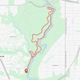 Miles: 4.2
Topography: Hilly
Surface: Pavement/Trail
GPS Data: GPX, KML, MMR, OSM
This loop originates at Peirce Mill. The first two miles of this loop are on road. It then loops back to Peirce Mill along the Valley Trail, with Rock Creek to your left. This loop has one long hill in the first mile, and one short, abusive hill in the last mile. Be aware that the Valley Trail is muddy after rains.
Equestrians are especially apt to use the Valley trail. We have learned that when you meet one, the proper procedure is to stop, and wait for the horse and rider to pass.
Directions
- Begin at Peirce Mill proceeding North
- At end of Parking lot and stop sign, take a quick left
- After 30 yards, take first right onto Glover Rd. This is an unmarked road
- Run up hill. Take first right on Ross Dr. Like Glover, this is an unmarked road
- Ross Drive is the most beautiful mile of road in Washington. The view off to the right is particularly striking in the winter, when the bare trees reveal the depth of the valley formed by the creek over centuries
- Take a right at stop sign that marks the end of Ross Drive
- Take immediate right on trail before bridge. You are now on the Valley Trail.
- Follow Valley Trail as it runs parallel to Rock Creek. Avoid all trails to the right.
- As you exit trail, you will be at intersection of Beach Drive and Broad Branch Road. Head straight toward parking lot. Peirce Mill is .2 miles south of parking lot.
Bingham Drive – Valley Trail Loop (5.8 miles)

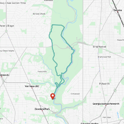 Miles: 5.8
Topography: Hilly
Surface: Pavement/Trail
GPS Data: GPX, KML, MMR, OSM
This loop originates at Peirce Mill. The first two miles of this loop are on road. The next 2.5 miles are along the Western Ridge trail. After descending to the Valley Trail, it turns east and South, as it heads back to Peirce Mill. The first half of the loop is characterized by challenging hills. The last half is flat. Beware of the Valley Trail after rains.
Equestrians are especially apt to use the Valley trail. We have learned that when you meet one, the proper procedure is to stop, and wait for the horse and rider to pass.
Directions
- Begin at Peirce Mill proceeding North
- At end of Parking lot and stop sign, take a quick left
- After 30 yards, take first right onto Glover Rd. This is an unmarked road
- Run up hill.
- Continue on Glover Road for two miles until you reach Military Road
- Cross Military Road. Turn right on paved bike trail. This marks the beginning of the Western Ridge Trail
- Continue on paved bike path to Bingham Drive. This will be the first thoroughfare you encounter.
- Turn right on Bingham Drive.
- Run down Bingham hill to Beach Drive. Turn right.
- Follow bike path one mile south to first stop sign.
- At stop sign, turn right and cross bridge. Take immediate left on the Valley Trail.
- Follow Valley Trail as it runs parallel to Rock Creek. Avoid all trails to the right.
- As you exit trail, you will be at intersection of Beach Drive and Broad Branch Road. Head straight toward parking lot. Peirce Mill is .2 miles south of parking lot.
Out of Capitol Hill
14th Street Bridge – Key Bridge Loop (9.3 miles)

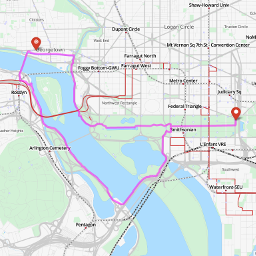 Miles: 9.3
Topography: Flat
Surface: Trail/Pavement
GPS Data: GPX, KML, MMR, OSM
The 14th Street Bridge – Key Bridge Route provides excellent views of the Washington Monument, Jefferson Memorial, Potomac River, Georgetown Skyline and of course the Lincoln Memorial. Be careful when crossing streets on Mall. Visitors in cars don’t always notice runners.
This route can be run on both weekdays and weekends.
Directions
- Start in front of U.S. Capitol (3rd and Pennsylvania, NW)
- Run up Mall to 14th street
- Take a left at 14th Street. Cross Independence Avenue
- Follow 14th Street past the Holocaust Museum on your left
- Cross Maine Avenue. The Tidal Basin will be on your right
- Keep the Tidal Basin /Jefferson Memorial on your right, as you follow path.
- When you see the bridge on the left, head straight for it. You will run on a bit of grass
- Cross 14th Street Bridge
- When you get to other side, head north along Mount Vernon Bike Trail
- Follow bike trail about 2.5 miles north until you reach intersection with road. Turn right.
- Cross Key Bridge.
- Take an immediate right immediately after crossing Key bridge. Go through the Francis Scott Key mini-park to the C&O canal.
- Do not cross the C&O. Rather run along north side of tow path in an eastward direction, toward DC (if you go under the Key Bridge, or across the canal, you have committed a faux pas)
- Follow tow path one mile to Rock Creek Parkway
- Turn right at Rock Creek Parkway. Follow path 1.1 miles to Lincoln Memorial.
- Take left at Lincoln Memorial to Mall. At this point you are less than two miles from the start
- Follow Mall (either side) back to the start.
Memorial Bridge – 14th Street Bridge Loop (6.3 miles)

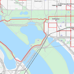 Miles: 6.3
Topography: Flat
Surface: Trail/Pavement
GPS Data: GPX, KML, MMR, OSM
The Memorial Bridge – 14th Street Bridge Loop provides excellent views of the Washington Monument, Lincoln Memorial, Potomac River, and The Jefferson Memorial. Be careful when crossing streets on Mall. Visitors in cars don’t always notice runners.
This route can be run on both weekdays and weekends.
Directions
- Start in front of U.S. Capitol (3rd and Pennsylvania, NW)
- Proceed up Mall 1.75 miles to Lincoln Memorial. Either side of Mall acceptable
- Go around Lincoln on the left (south) side.
- Proceed across Memorial Bridge
- After crossing bridge, bear left
- Cross over the G W Parkway. Bear left, towards Mt. Vernon Bike Path that runs parallel to Potomac River
- Proceed south along bike trail to the 14th Street Bridge. This will be the first bridge you encounter
- Cross over Potomac on 14th Street Bridge.
- Stay on sidewalk with road to your right, and the Jefferson Memorial to your left
- Cross Maine Avenue. Get on 14th Street going north (you will be heading toward the Washington Monument)
- When you come to 14th Street and the Mall, take a right on Mall. Return to where you started.
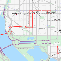
Memorial Bridge – Key Bridge Loop (8.7 miles)

 Miles: 8.7
Topography: Flat
Surface: Dirt/Sidwalk
GPS Data: GPX, KML, MMR, OSM
The Memorial Bridge – Key Bridge Loop provides excellent views of the Washington Monument, Lincoln Memorial, Potomac River, and the Georgetown Skyline. Be careful when crossing streets on Mall. Visitors in cars don’t always notice runners.
This route can be run on both weekdays and weekends.
Directions
- Start in front of U.S. Capitol (3rd and Pennsylvania, NW)
- Proceed up Mall 1.75 miles to Lincoln Memorial. Either side of Mall acceptable
- Go around Lincoln Memorial on the left (south) side.
- Proceed across Memorial Bridge on left (south) side.
- After crossing bridge, bear left
- Cross over the G W Parkway. Bear left, towards Mount Vernon Bike Trail that runs parallel to Potomac River
- Turn left on Bike Trail. Proceed north.
- Follow trail about two 1.5 miles north until you reach intersection with road. Turn right.
- Cross Key Bridge.
- Take an immediate right immediately after crossing Key bridge. Go through the Francis Scott Key mini-park to the C&O canal.
- Do not cross the C&O. Rather run along north side of tow path eastward, toward DC (if you go under the Key Bridge, or across the canal, you have committed a faux pas)
- Follow tow path one mile to Rock Creek Parkway
- Turn right at Rock Creek Parkway. Follow path 1.1 miles to Lincoln Memorial.
- Take left at Lincoln Memorial to Mall. At this point you are less than two miles from the start
- Follow Mall (either side) back to the start. Beware when crossing streets.